Field data for the entire US
FieldStat provides data on 14 million agricultural fields across the United States. Detected boundaries, crop history, terrain, soil and landowners —
delivered via API or bulk export.
Get in touch to discuss your use case, get a free data sample and start an API trial.
delivered via API or bulk export.
Get in touch to discuss your use case, get a free data sample and start an API trial.
We'll reply within one business day
FieldStat data layers
Boundaries, crops, terrain, soil and landowners, combined in a single dataset

Field boundaries
Precisely detected
from satellite imagery

Cultivated crops
Last season + 10 years of rotation history

Terrain & soil
Slope, soil texture class, organic carbon

Landowners
Based on matched
land parcels
land parcels
- State-of-the-art boundary accuracyField boundaries are detected from RGB & NIR Sentinel-2 bands. The pipeline is based on ResUnet-A segmentation and ESRGAN super-resolution. We achieve an IoU of 0.93 against manually delineated boundaries in test areas across 15 states.
- Industry-standard data sources
Additional data layers are based on industry standards, such as USDA Crop Data Layer and USDA-NRCS Soil Survey Geographic Database.
- Nationwide coverage & yearly updates
Data is available for the US nationwide and various other geographies — please reach out to us to discuss other areas of interest. Boundaries and additional layers are updated yearly.
- API and bulk delivery with transparent pricing
We deliver data either through an API — check out the documentation — or as a bulk dataset in the format of your choice. Pricing depends on delivery method, area of interest and refresh frequency; we'll quote after a short conversation about your use case.
See the actual data before you talk to us
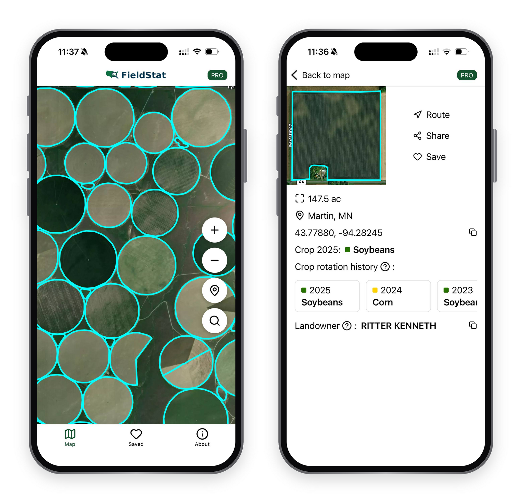
Live data is available in the FieldStat app for iPhone and Android
- Over 14 million mapped fields across the US
- Explore field boundaries, acreage, crop rotation and landowners
- Save and share fields of interest
FieldStat data use cases
- FMS and digital farming appsSimplify onboarding, automatically add fields and provide valuable insights without manual data entry
- Sustainability and complianceEnable traceability and compliance monitoring, identify fields suited to regenerative practices
- Ag financing and insuranceValidate the information provided for payouts and financing, streamline claim automation
- Market intelligenceGain insights into crop production, input demand and
farm property